 Dynamic
Data Company
Level up your Geo data
with our technology
Welcome to the fastest ever-changing dynamic data
Contact Us Dynamic
Data Company
Welcome to the fastest ever-changing dynamic data
Contact UsPapli AI has a bunch of features and tools that help the user carry out their operations more efficiently.

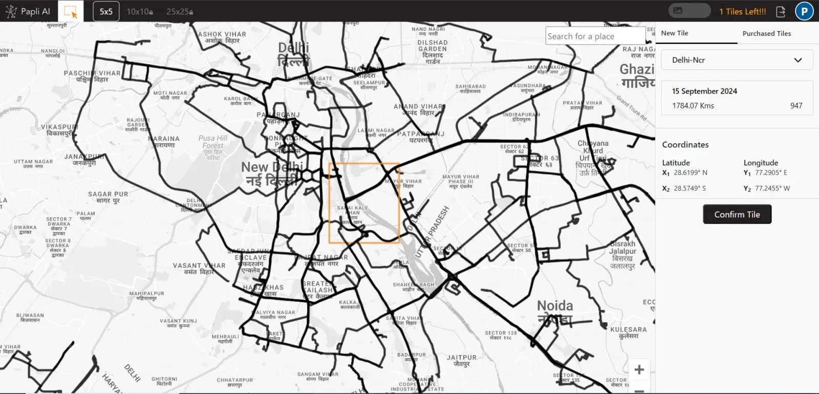
Tiles help define the boundaries of a specific area and are used to analyze and derive road activities within that region.

Allowing users to select and view data from a specific date and time. This information can be saved for future reference.

Provide detailed views of road characteristics such as metro lines, buildings, and speed bumps, helping you gain insights about the area.

Users can easily export their selected data into a well-organized Excel document. This file will include time, date, images and coordinates.
Papli AI has a bunch of features and tools that help the user carry out their operations more efficiently.
Papli AI is built for user satisfaction. This personalised approach provides greater clarity, as it offers customised options for users to filter from Papli AI significantly improves the overall user experience and simplifies daily travel.
Papli tiles offer detailed road insights, including obstacles and traffic conditions. Users can view this information to avoid problematic routes and choose faster alternatives. You can avoid waterlogged and congested areas after rain by checking the app.
Papli AI enhances travel safety by providing advanced information on road activities, helping users choose safer routes and stay informed during their journey. This Helps to prevent road rage , accidents and overall helps to avoid unsafe environments.
Papli AI provides extensive information for city analysis. For example, an advertising company can use the app to assess traffic levels at potential billboard locations, helping ensure a profitable investment.

Data processed by Papli AI daily
Data stored of any date & time
Covering whole India as for now
Grow your business and drive by setting up automations that trigger personalized mapping based on your requirement with our Papli AI tool.